- Client:
- US Census Bureau
- Project:
- Census Transportation Planning Package 2000
- Duration:
- 2 Years
- Project Cost:
- $500,000
- Software:
- ESRI GIS, Beyond 2020
- Distribution:
- 20,000 State and Local Government Agency and Municipal Planning Organization users.
Project Description:
The Census Transportation Planning Package (CTPP) is a set of special tabulations from the decennial census designed for transportation planners. CTPP contains tabulations by place of residence; place of work, and for flows between home and work. CTPP 2000 is a cooperative effort sponsored by the State Departments of Transportation under a pooled funding arrangement with the American Association of State Highway and Transportation Officials (AASHTO).
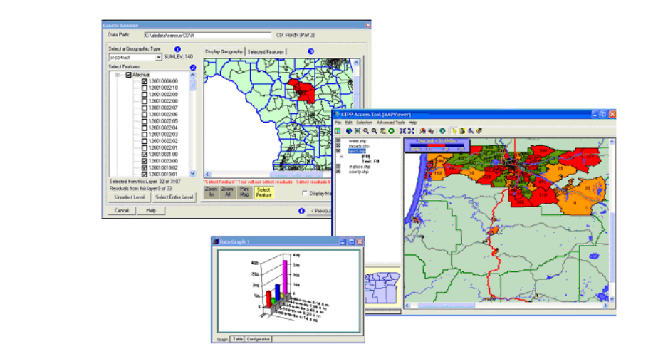
CGL was contracted by the US Census Bureau to develop the software interface to allow access to the data and provide a lightweight GIS application for viewing of the map and transportation data. The project was performed in 3 phases coinciding with the release of the 3 data parts of the program.
The ESRI software used for this effort was the MapObjects for windows Active-X development environment. CGL augmented the MapObjects product with its own CLegend and MapCanvas Active-X products. The Clegend control provides the map legend and the ability for the user to customize the map interface. The MapCanvas product provided the end user with the ability to create custom map layouts for output to printer and plotter devices.
The completed product was shipped on CD and DVD-ROM format to over 20,000 users of the data, including State and County Departments of Transportation and various local Planning Agencies.