- Client:
- US Army Geospatial Centerd
- Project:
- BAA for GIS Conflation Software and Services
- Duration:
- 7 Years
- Project Cost:
- $600,000
- Software:
- ESRI ARCGIS, ArcObjects, MapObjects, Visual Studio
- Distribution:
- AGC, NGA, JWAC
Project Description:
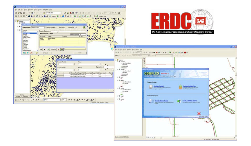
Development of Automated Road Feature Matching and Data Integration Technology for the US Army. The process of merging of data developed from different sources is a complex and often time consuming process. In 2001, Citygate conducted an internal study evaluating the various technologies available for automated pattern recognition and data fusion. The study found that the traditional methods focused on proximity analysis. This approach worked when the disparity between the source and target road databases were uniformly distributed. However, when errors are unevenly distributed, this approach would result in endless cycles of processing with a significant need for manual intervention. This approach does not work when working with large quantities of data or live sensor information which must be analyzed instantly.
ConfleX was a revolutionary product which enabled automated feature matching of datasets without the need for manual intervention. The software used artificial intelligence through a statistical matching process which simultaneously evaluated attributes such as proximity, directionality, topology and connectivity. The software could operate in a completely automated environment without the need for any human intervention.
The US Army’s Geospatial Center (AGC) had spent over 10 years funding development projects with companies such as Intergraph and Northrop Grumman, developing automated feature matching technology for use by the various data development agencies within the military. AGC’s initial evaluation of Citygate’s Conflation technology and found that version 1 of ConfleX exceeded the match rate of their existing systems by over 20%, achieving nearly 90% automated matches. Citygate was retained to work under a development and customization contract to enhance the ConfleX product for specific military applications, including work with the Joint Warfare Analysis Center (JWAC) and the National Geospatial Agency (NGA).